Serra da Estrela
Serra da Estrela
Portugal's highest mainland mountain range, a UNESCO Geopark, Serra da Estrela combines granite peaks, glacial valleys, skiing and pastoral villages.
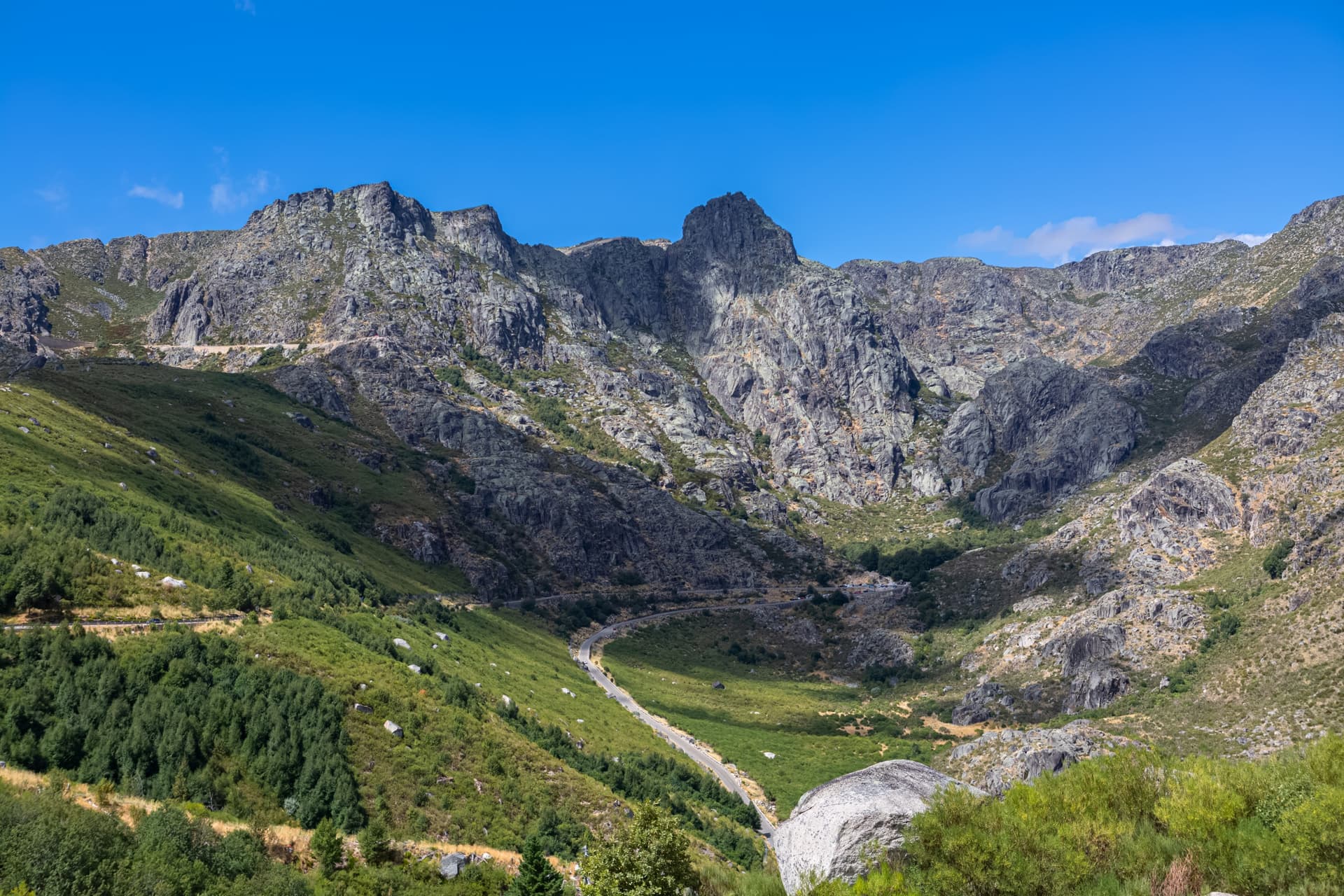
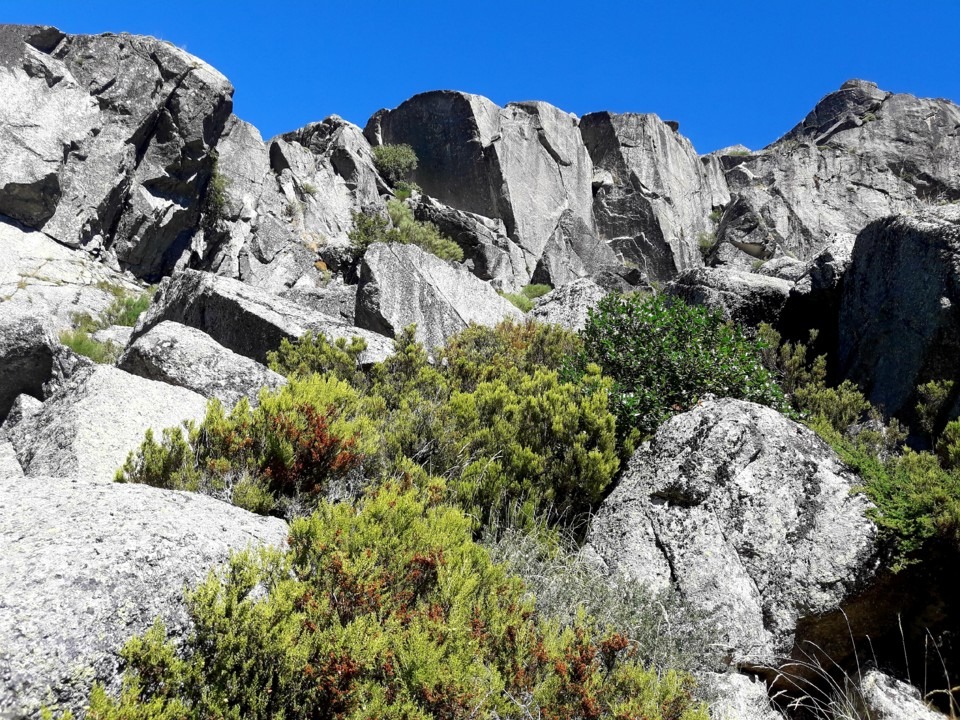
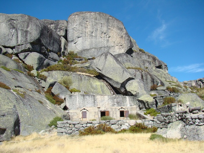
Serra da Estrela is the highest mountain range on mainland Portugal. Located in the centre of the country, near Covilhã, it combines granite peaks, glacial valleys, mountain lakes and pastoral villages. Recognised as a UNESCO World Geopark since 2020, the natural park covers nearly 900 km² and is one of Portugal's main protected areas.
Why visit Serra da Estrela
The range brings together several rare landscapes at this latitude: winter snowfields, high plateaus, ancient forests and 25 glacial lakes. It is home to Torre, mainland Portugal's highest peak at 1,993 metres, and the Mondego, the longest river entirely within Portugal, which has its source here.
Serra da Estrela also has a distinct cultural identity. The town of Covilhã, on the southern slope, is a former wool-milling centre where textile craftsmanship remains vibrant. High-altitude villages preserve a pastoral tradition embodied by the Cão da Serra da Estrela, one of the oldest known dog breeds and the region's emblematic sheepdog.
History
During the Roman expansion, the range was called the Mounts of Hermine (Mons Herminius). The Lusitani, pre-Roman peoples of the Iberian peninsula, waged a long guerrilla war against the Roman invasion, using the cliffs and forests to slow down the legions. Serra da Estrela was one of the last regions to fall under Roman control.
Pastoralism has shaped the territory for centuries: transhumance, sheep cheese production, and the breeding of sheepdogs. The natural park was created in 1976, and the UNESCO World Geopark designation in 2020 recognises the geological value of the range, particularly its well-preserved glacial features.
What to see and do
Torre and the high plateaus
The Torre summit is accessible by car via route N339, making it an easy viewpoint to reach. Several ridge trails depart from the surrounding area and allow walks across the granite plateaus. A stone marker indicates the highest point. For a more thorough exploration of the summit and its trails, see our dedicated page on Torre.
Glacial valleys of Loriga and Zêzere
These two U-shaped valleys are Portugal's finest examples of glacial erosion. The Zêzere valley, accessible from Manteigas, reveals a flat floor framed by steep slopes. Loriga, further south, displays rock bars and clearly visible moraines.
Lakes and river beaches
The range has around twenty mountain lakes (Covão dos Conchos, Lagoa Comprida) and several managed river beaches in the valleys (Loriga, Valhelhas, Vide), popular in summer for swimming.
Villages, gastronomy and crafts
- Covilhã: textile craftsmanship and woollens from the local cloth-making tradition.
- Seia: Bread Museum (Museu do Pão), dedicated to cereal crops and regional breads.
- Manteigas and Linhares da Beira: characteristic slate and granite villages.
- Queijo da Serra da Estrela: creamy sheep's cheese with PDO status, to be savoured with Seia bread.
Sports activities
The park offers approximately 370 km of marked trails for hiking, mountain biking and horse riding. In winter, the Vodafone Ski Resort near Torre opens ski slopes, sledging and snowboarding runs, usually from December to April depending on snow conditions.
When to visit
The altitude creates a microclimate very different from the rest of Portugal. Winter (December to April) is cold, often snowy at altitude, and concentrates activity at the ski resorts. Spring (May-June) and early autumn (September-October) are the most pleasant periods for hiking: mild temperatures, long days, spring blooms or autumn colours. Summer is dry and sunny, but can be hot in the valleys; river beaches are then busy. Rain is concentrated in autumn and winter.
How to get there
Serra da Estrela is approximately 3 hours 30 minutes' drive from Lisbon and 2 hours 30 minutes from Porto. A car remains the most practical way to explore the range, villages and summits, as the public transport network within the park is limited.
- By car: A1 motorway then A23 from Lisbon, exit towards Covilhã, Manteigas or Seia depending on which slope you choose.
- By train: Beira Baixa line to Covilhã or Guarda from Lisbon (Oriente). Car hire recommended upon arrival.
- By bus: long-distance coaches (Rede Expressos) connecting Lisbon and Porto to Covilhã, Seia and Guarda.
Practical information
- Length of visit: allow a minimum of 2 days to discover the main sites; 4 to 7 days for serious hiking.
- Equipment: warm clothing and windproof jackets all year round at altitude, hiking boots, sunscreen (strong glare on the plateaus).
- Driving: winding mountain roads, sometimes closed in case of snow; check conditions in winter.
- Accommodation: village hostels, rural houses and hotels in Covilhã, Manteigas, Seia or Gouveia.
- Information centres: park offices in Seia and Manteigas for maps, trail information and advice.
To combine in the region
Serra da Estrela can be part of an itinerary in central and northern Portugal. Within a reasonable radius, see:
- Prehistoric rock art sites of the Côa valley, UNESCO listed, east of the range.
- Alvão natural park, further north, to extend the medium-mountain experience.
- Bread and Wine Museum of Favaios, in the Douro, a culinary complement to the Bread Museum in Seia.
- Quinta da Avessada, in the wine-producing Douro, for a wine break.
Plan your trip
Serra da Estrela lends itself to an itinerant stay combining nature, villages and gastronomy. To build an itinerary suited to your dates and pace, consult our ideas for trips to Portugal.
Nearby
Interested in this visit?
We can include it in your personalised itinerary.